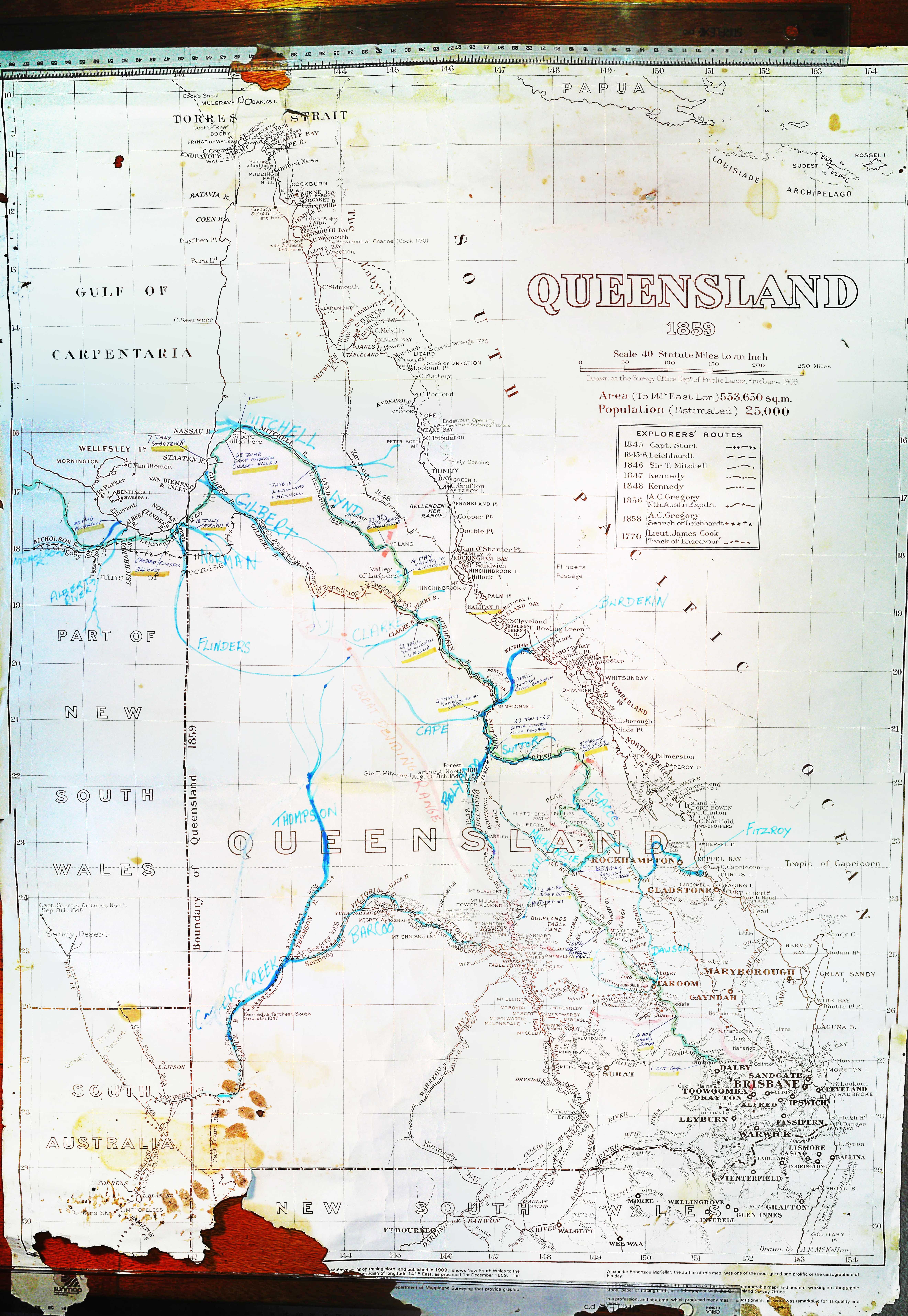
Explorers tracks

Explorers tracks
I came across an interesting document while cleaning out the accumulated records of the Archer Brothers at Gracemere to make way for a new floor. Well I didn’t Ruth, Anne and Mary were shredding for days. I narrowly rescued it from the incinerator. (Actually they were careful to keep any potentially interesting documents.)
It's a map of Queensland drawn in 1909 to reflect Explorers tracks in 1859.
Captain Sturt, Leichhardt, Mitchell’s two expeditions, Sir Gregory's two and Lieutenant James Cook's expedition.
It is interesting to note that in1859 the population of Queensland was estimated 25,000. There has been a bit of “going forth and multiplying”. Now about 5.257 million.
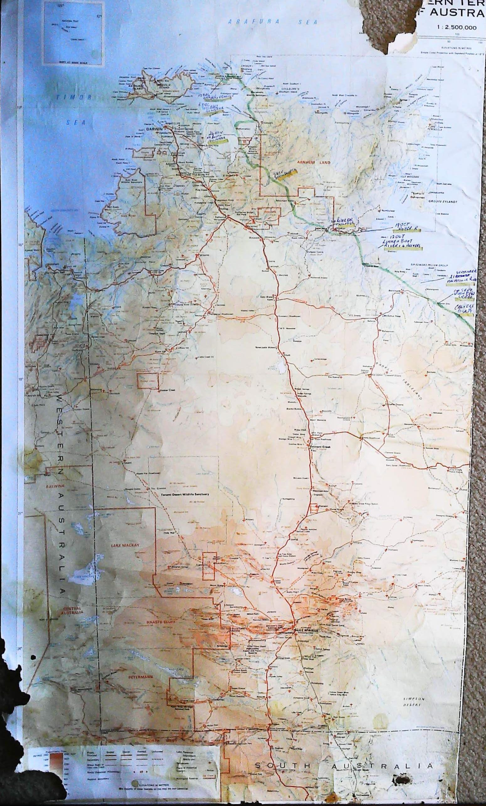
The map has been carefully marked-up my father-in-law Cedric who must have used Leichhardt’s journal to pick up camp locations and dates on the expedition. Interesting to see how slowly they travelled. (We are planning to cover most of his route in Queensland in about 6 days in July.) Looks like Leichardt headed off from Juibour near Dalby 1 Oct 1844 and left Queensland for the Northern Territory (What was at that time still New South Wales) late August 1845. His expedition continued into the Territory to a point east of Darwin, Port Essington. (Cedric also marked up the NT map but I have not had the patience to scan it.)
We think that Cedric marked up the map to give a talk probably at a high school in Rockhampton. Not sure of the date around 1970? I'm sure that he would have delivered an entertaining and lively presentation. He was a real showman.
Leichhardt was something of a hero to the Archer family because it was on his advice that they went to look at the country south of the Fitzroy River close to what is now Rockhampton.
Legend has it that they stood on the Mount Morgan Range and looked out over the flood plains and said that would be a good place to run a few sheep. They neglected to look under their feet which turned out to be the richest goldmine in the world. A bit like the Duracks who established Argyle cattle station on what became the richest diamond mine in the world!
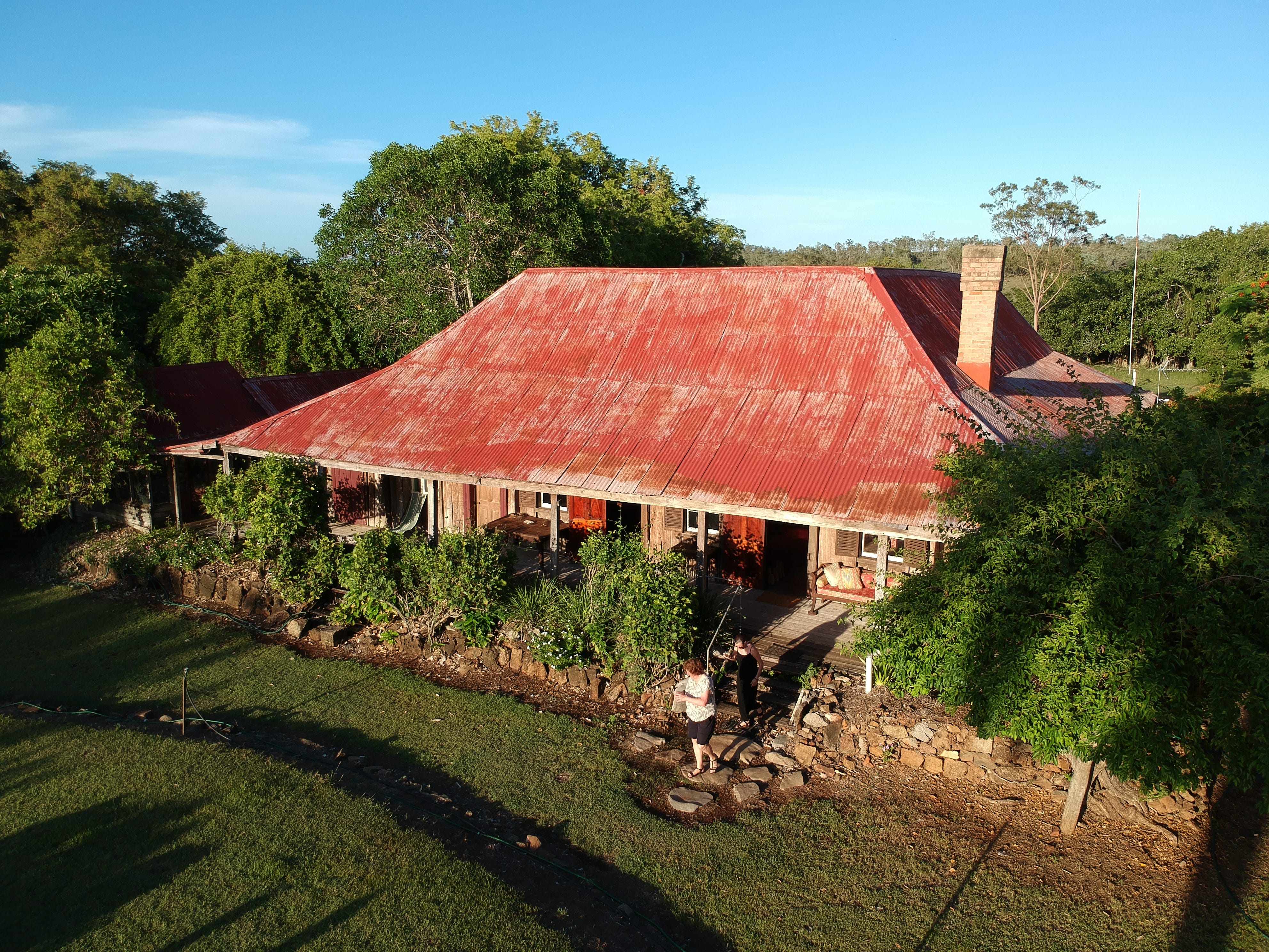
The Archers of course took up country at Gracemere where the family are still holding out now running cattle living the old house build about 1860. The first settlers house in Central Queensland.
This was not Leichhardt’s last expedition as he evidently returned to publish his journal of this expedition. I think the journal is published and is probably amongst the thousands of books still at the homestead. (Journal of Dr. Ludwig Leichhardt's overland expedition to Port Essington in the years 1844-45, revised by the explorer, and published with his sanction, 1846 [Copy 1] | State Library of NSW)
Mystery surrounds Leichhardt’s final expedition as he vanished somewhere in the Territory (possibly) and his fate is unknown. Reports of his final tracks vary by thousands of kilometres.
The map has suffered a bit unfortunately living amongst the cockroaches, silverfish, nesting mud hornets and many other things.
Thanks to a horrible bit of software called Hugin for stitching 8 scans of the map together. It is big A1 or A0. Much more tedious than I had in mind but it did a reasonable job. Not much good on a mobile phone but hopefully you can blow it up to read the details. I think the detail is there. Might have to copy and paste into a viewer.